
In August 2023, San Antonio broke the record for most days in a single year above 100 degrees Fahrenheit. That surge may become a new normal. The Office of the Texas State Climatologist expects that by 2036, the number of 100F days will nearly double the 2001-2020 average.
Summers are going to keep getting hotter.
But some parts of town are going to get hotter than others. Urban heat does not spread evenly. Instead, cities have to deal with the urban heat island effect. Urban heat islands occur when cities have dense concentrations of pavement, buildings and other surfaces that absorb and hold heat. The heat is trapped.
In San Antonio, urban heat is scattered throughout the city. But the most intense concentrations are within the urban core and the neighborhoods around it, including the near Westside, Eastside and Southside.
The urban heat island effect can increase the intensity of heat waves and air pollution. It is not good for public health. More heat means more ozone (aka smog). Breathing ground-level ozone can lead to chest pain, coughing, congestion and can worsen asthma, emphysema and bronchitis. On urban heat islands, people suffer more.
San Antonio’s Tree Canopy
The good news is urban heat island effects can be mitigated. One study found that added vegetation during an extreme heat wave in Washington D.C. and Baltimore cooled down the cities. Research abounds on how trees can help cool down cities and consequently save energy. (Who doesn’t love lower electricity bills?!).
The EPA provides a good list of scientifically proven ways that trees help reduce urban heat islands.
How does San Antonio compare to other major Texas cities when it comes to urban heat, tree canopy, and clean air? American Forests puts together a composite score that assesses the extent to which the advantages of trees are being equitably distributed to low-income communities, communities of color and other groups disproportionately affected by extreme heat and various environmental risks. The score ranges from 0 to 100 and is calculated at the neighborhood level, in addition to a composite score for larger geographic areas or cities.
San Antonio currently holds a composite score of 79. Austin, Dallas and Houston hold composite scores of 91, 86, and 87, respectively. These scores are important because they capture the impact of the urban heat island effect. They also incorporate many other factors, including health and socioeconomic indicators that can highlight priority neighborhoods for additional tree canopy.
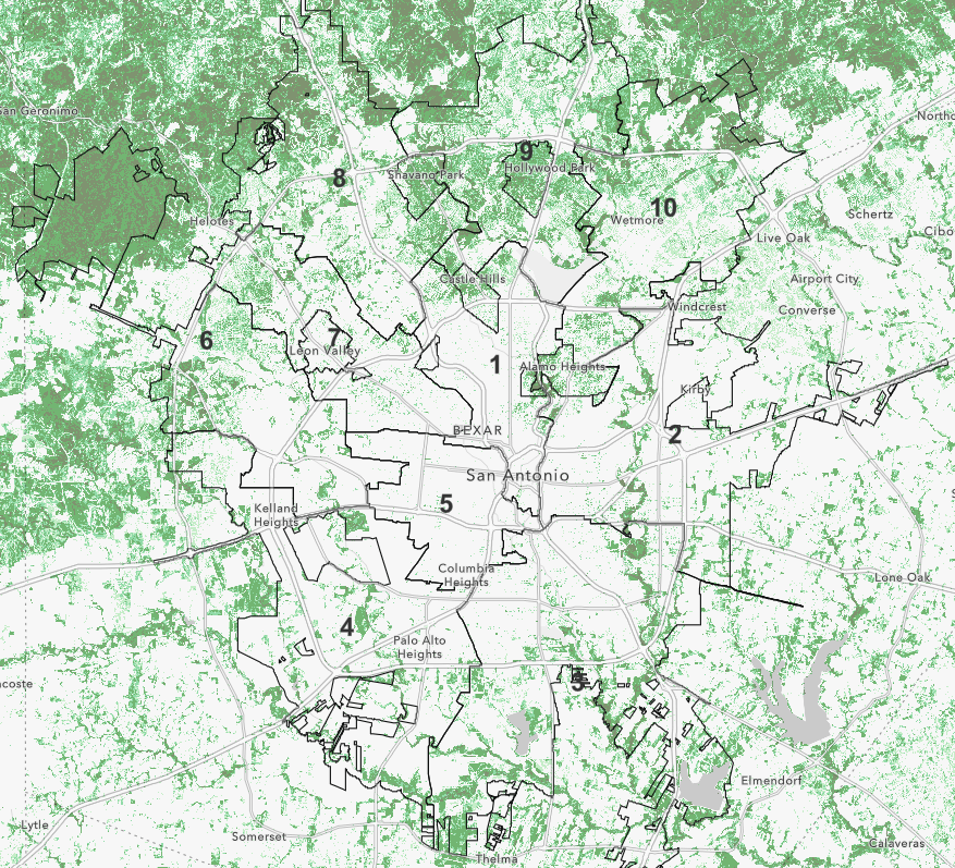
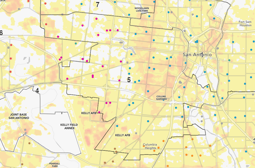
The City of San Antonio’s 5th district—the historic near Westside—has considerably less tree canopy cover compared to most other districts. Figures B and C present a tree canopy cover map where the density of canopy cover is indicated by clusters of green pixels.
Within District 5, green pixels are scarce. (Figure C)

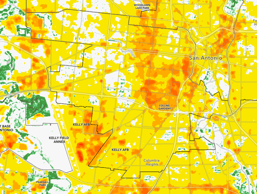
When we look at urban heat severity overlaid onto the tree canopy map, we are able to see how tree canopies mitigate heat.
The map below helps us see which parts of cities are hotter than the usual temperature for the whole city. The severity of the heat is rated on a scale from 1 to 5. Level 1 means it’s a bit warmer than the city’s average. Level 5 means it’s much hotter than the city’s average.
Looking carefully at District 5 (Figure D), we can see that areas with clusters of green (dense tree canopy) are less surrounded by yellow. That indicates a Level 1 heat severity.
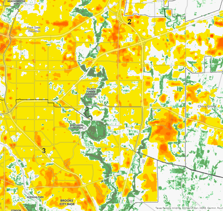
We see a similar pattern when we follow the Salado Creek Greenway. The tree canopy along the greenway provides a buffer against the heat produced by our city’s infrastructure (Figure E).
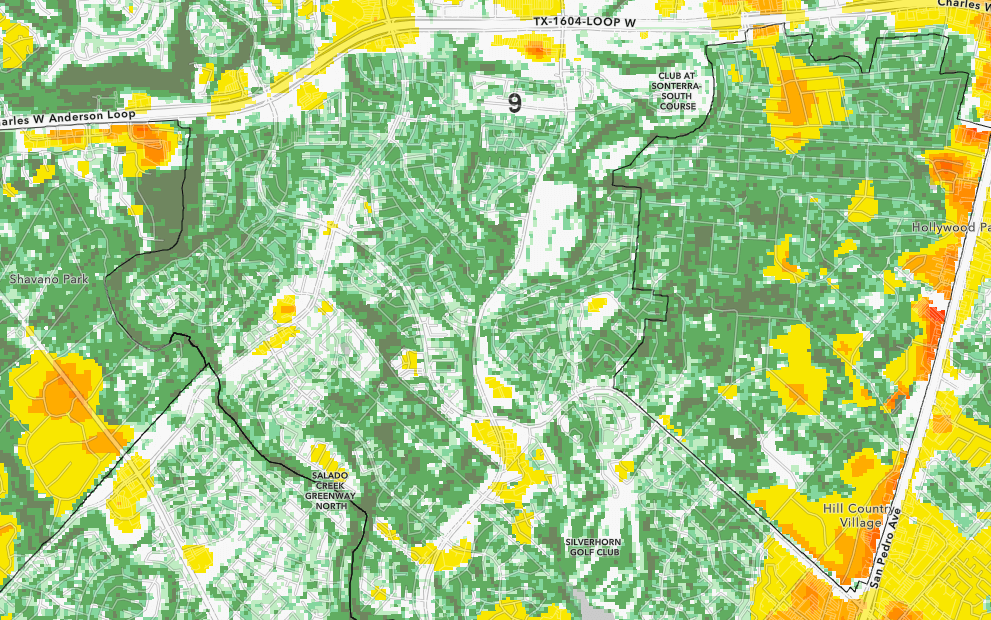
Now let’s look at the densely residential areas within Districts 8 and 9, in the north and northwest part of town. These districts have similar residential density—numbers of people living there—to the near Westside. But they have far, far more tree canopy (Figure F).
While the residential density is similar, District 5 not only has fewer trees but also the highest concentration of public schools within its bounds (Figure H). Higher heat affects air quality and can lead to worse health for our youngest residents. In 2020 alone, the number of inpatient hospitalizations with an asthma diagnosis for children ages 17 and younger in Bexar Country was just over 300 cases of all severity levels.
To state things plainly: throughout San Antonio, people with the lowest wealth also have the fewest trees. To name just one comparison, District 2’s median income is approximately $46,723, while more tree-dense District 8 has a median household income of $66,048.
Of course, families living in neighborhoods today did not create the policies or the infrastructure that led to this disparity in tree canopy. The trees are telling us about our past—they are signs of the misguided, misinformed policy priorities and decisions of our forbears.
But it is also true that well-crafted policies can play a role in rectifying these disparities and creating new opportunities within our communities. As we think about the kind of city we want to be, we should be paying attention to the trees.